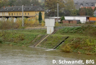
|
Stationsdetails
|
| Name |
Perl |
| Wasserlauf |
Moselle |
| Einzugsgebiet am Pegel |
11522,0 km²
|
| Nullpunkt |
138,5 m NN. |
| Flusskilometer |
241,8 km |
| Koordinaten (LUREF)
|
94572 E |
59769 N
|
| Anrufbeantworter |
|
|
Rezenteste Messdaten
|
| Datum |
11.07.2025
|
| Zeit |
07:00
|
07:15
|
Differenz
|
|
| Wasserstand |
212
cm
|
214
cm
|
2
cm
|
|
Offizieller Meldepegel.
HINWEIS: Durch Staustufe beeinflusst (Schleuse)!
Aus technischen Gründen ist eine Wasserstandsvorhersage an diesem Pegel erst über einem Wasserstand von 250 cm möglich. Alle darunter liegenden Werte werden daher als konstante Linie dargestellt.
|
Hauptwerte
|
| Für diesen Pegel sind keine Hauptwerte eingetragen. |
|
Statistische Werte
|
|
Abfluss
|
Wasserstand
|
| Für diesen Pegel sind keine statistischen Werte eingetragen. |
|
Historische Wasserstände
|
|
Datum
|
Wasserstand
|
Abfluss
|
| Für diesen Pegel sind keine historischen Hochwasserstände eingetragen. |


