


MeteoLux Current Weather Forecast
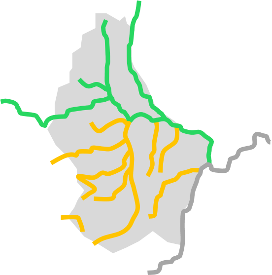
Luxembourg (without Moselle)
Saturday
18.05.2024 17:57
The flood warning service is in pre-alert status. Risk of minor floods generating possible damages in flood prone areas. Pay attention in case of seasonal activities in these areas. Update by change of situation.
Danger Saturday 18.05.2024
The water levels on the Sauer and its tributaries are falling at all gauges and are currently below the "cote de préalerte".
Water levels are also falling on the Alzette and its tributaries. At the Hesperange, Steinsel and Mersch gauges, the water levels will fall below the "cote de préalerte" during the course of the night.
A flood report is available for Luxembourg (without Moselle):
Flood Report Luxembourg (without Moselle) (PDF)
Auswirkungen & Empfehlungen
Mögliche Auswirkungen
- Lokale Überschwemmungen, die vereinzelte Wirtschaftszweige beeinträchtigen könnten.
- Mögliche Überschwemmungen in den gewohnten Überschwemmungsgebieten.
- Erschwerte Straßenverkehrsbedingungen.
Verhaltensempfehlungen
- Verfolgen Sie die aktuellen Hochwasserwarnungen auf www.inondations.lu und Wetterwarnungen www.meteolux.lu, beziehungsweise im Radio oder Fernsehen.
- Vergewissern Sie sich ob ihre Gegend betroffen sein könnte anhand der Hochwassergefahrenkarten auf geoportail.lu, Thema Wasser.
- Laden Sie Ihr Handy und (falls vorhanden) eine „Power Bank“, um im Ernstfall das Handy auch ohne Stromzugang wieder aufladen zu können.
In hochwassergefährdeten Gebieten
- Stellen Sie den Strom in allen Räumen, die durch das Hochwasser gefährdet sind, ab.
- Schalten Sie Ihre Heizung ab und unterbrechen Sie die Gas- bzw. Ölzufuhr. Vergewissern Sie sich, ob Ihr Öltank ausreichend gesichert ist.
- Packen Sie alle wichtigen persönlichen Dokumente und Unterlagen zusammen und lagern Sie diese außerhalb des Gefahrenbereichs. Auch sollten Sie einen Schlafsack, Gummistiefel, und eine Taschenlampe bereithalten. Denken Sie an Ihre Medikamente.
- Lagern Sie gesundheits- und umweltgefährdende Stoffe außerhalb des Hochwassergefahrenbereichs.
- Bringen Sie Ihr Auto aus der Gefahrenzone (nur wenn noch genug Zeit dafür ist).
- Lesen Sie den Flutschutzplan Ihres Gebäudes (falls vorhanden) aufmerksam durch.
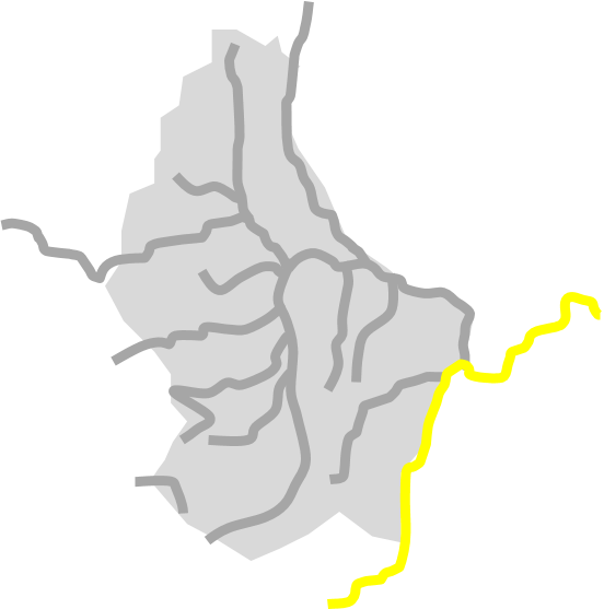
Moselle
Saturday
18.05.2024 16:08
The flood warning service is on standby. The meteorological situation is indicating a potential risk of floods, be prepared. Update by change of situation.
Potential danger Saturday 18.05.2024
Today and tomorrow, the water levels remain in an elevated range around the water level of 530 cm at the Stadtbredimus gauge (Remich: 452 cm).
A temporary high of 532 cm was reached at the Stadtbredimus gauge during the night. A slight rise in water levels is possible. However, this forecast is still subject to uncertainty.
Please note:
The high water levels on the Saar cause additional backwater on the Moselle. However, this influence is difficult to predict. The water levels in Wasserbillig (Moselle and Sauer) may therefore be significantly higher than calculated and flooding must be expected. The CGDIS emergency services are on heightened alert in this regard.
As far as the situation in Remich is concerned, the Remich-Stadtbredimus connection is temporarily affected by work on a gate at the Stadtbredimus dam. This situation is not expected to have any appreciably aggravating consequences compared with comparable floods in the past.
A flood report is available for the Moselle: